
 |
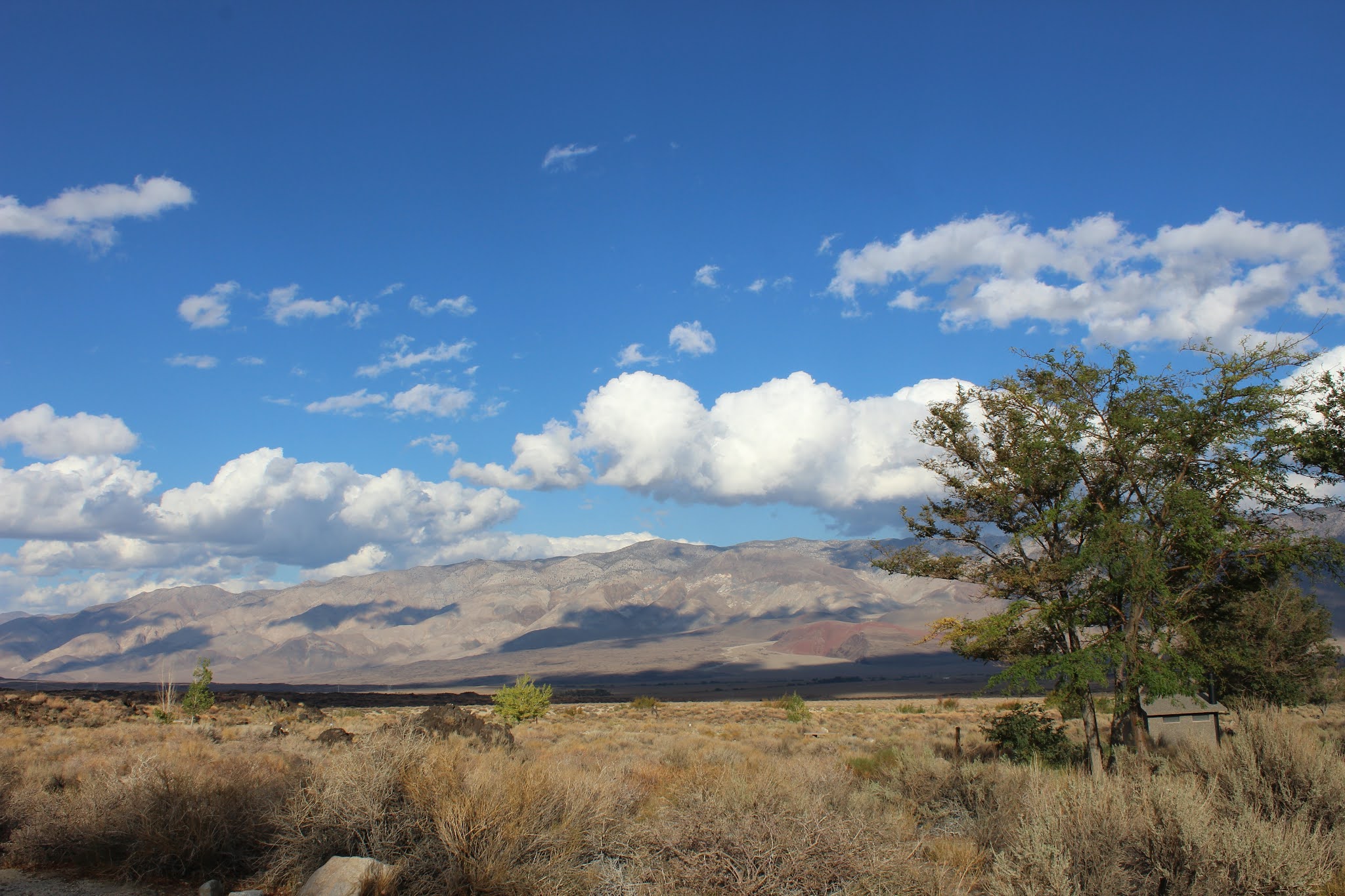
| The Inyo Mountains from the secret campsite |
After dealing with some mini-disasters related to bad packing and insufficient plumbing expertise, we settled in for a reasonably comfortable couple of "shake down" days at Copper Breaks State Park near Quanah, TX. Our first hint of trouble arrived as we drove into Trinidad Lake State Park, in southern Colorado, and started mapping out our route for the next day. We were rather gob smacked to learn that the predicted weather for the next few days in mountainous central Colorado involved nights dipping below freezing, so we quickly changed plans to head for the Colorado/New Mexico border instead, to Navajo State Park, and stay there for a couple of days in order to re-map the route. We’d have to traverse the fabled Wolf Creek Pass, but the aspens had started changing color and the views were spectacular.
The stay at Navajo was quite pleasant, even though it offered us the first of many reminders of encroaching drought (very low lake levels), and gave us time to rethink our plans a little. We shifted over to Utah after that, and moved up toward Salt Lake and across to Nevada, where we rejoined our original route and drove up the "most dangerous highway in the US" (93) to Idaho to visit family near Boise. The foretold danger--on an otherwise smooth, well-paved, lovely road--appeared in the form of a nasty multi-vehicle accident that parked us for an hour and a half. We still made it to the Boise area in good time, though, and had a nice visit with my step-family, who had only recently moved up from southern California. From there we drove through a good chunk of eastern Oregon into Washington, over the Cascades, and spent time with my son and his wife in their new-ish rainforest aerie in Redmond, WA, my former student Jane and her husband in Bellevue, and my uncle, aunt, and cousins and family in the Greater Tumwater Area (where we got to see my cousin Jeff's champion pumpkin before it shuffled off to glory in Half Moon Bay, CA). We ended up spending three days in Tumwater, enjoying my aunt Geri and uncle Art's gracious hospitality and amazing food. Molly and Nylah had a great time running around in the house and yard sans leash, for the first time in two weeks.
 |
| Remnants of the Dixie Fire |
The trip down was lovely, with dramatic clouds, a significant dusting of new snow, and gorgeous views down to Mono Lake. We dropped in at a viewing spot near the tufa and snapped a couple of pictures, and then drove to Big Pine where we filled our freshwater tank. Our preferred RV park in Lone Pine was full, so we decided to try one of the BLM areas (not the Alabamas, which have become an RV cult spot). We found a terrific campground that would only cost us USD 2.50 per night thanks to our Geezer Parks Pass. I’ve opted not to name it, because I’m a selfish old bat and just don’t want to share the discovery. But we loved it, the animals loved it, and we had three days of peace with only one “neighbor” for two of them. TBS hooked up the solar array and kept us in electricity, and we got in some hiking and trips to sacred family sites in the valley.
 |
| Bridgeport Reservoir, with geese if you look closely |
 |
| New snow in Mono Country |
 |
| Mono Lake from outside of Bridgeport |
 |
| Mono Lake Tufa |
 |
| View from the campsite with haze from Sequoia/Kings Canyon fires |
Unfortunately, this idyll marked the end of our journey out, and everything that followed focused on getting us back to Texas, which would require more re-routing, a missed opportunity to visit my beloved 99 year-old cousin Willma in Sedona, and some of the scariest driving we’ve ever experienced. We were leaving just in time to avoid a freeze, but also just in time to have to negotiate one of the periodic katabatic wind storms I’ve known since I was a child.
Owens Valley frequently experiences very high-velocity winds that blow from north to south and west to east (at the same time). The dust kicked up by these storms, especially off of Owens Lake (mostly dry) and the dunes at the southern end of the valley can blind drivers and cause horrific accidents on 395. After attending to some necessities (fixing Porco's flat, dumping our tanks, and visiting the Interagency Visitor Center for Valley swag), we got on the road just as the storm got serious. We probably should have waited it out for another day, but decided to take it slow and easy, and to get off the road if necessary; it was supposed to freeze in Lone Pine that night, so our options were slim. Our rig is relatively short (20’ for Porco, 20’ for the Gladiator), and pretty low-profile, presenting less of a wind target than most RVs.
We managed to get around one accident blocking the southbound lane by moving over to Old 395, and later saw two semis overturned in the northbound lanes. We got to Pearsonville before we lost visibility, and pulled off. GPS told us that we were near where the highway curved east, so as soon as it was clear enough to see anything, we drove past the junction with CA 14, just as it was being closed, and found out that 395 had been closed both north and southbound. Turning east meant that we had the wind at our tail, were out of the valley, and the most dangerous part was over.
 |
| Coming into Kramer Junction |
After that we got some of the best mileage of the trip. The winds caught up with us as we turned south again, but they weren’t nearly as strong. We ran into another visibility problem as we drove into Kramer Junction (the only photos I got of the storm were through the windshield here), but instead of 0 feet, we could see for 10 or 15. By the time we stopped for gas, the dust was gone, and we were headed east again: to Needles for the night, and then on to a stretch of old Route 66.
While we were cruising along the next day, reading old Burma Shave signs and stopping at a couple of tourist traps, we learned that the overnight temperatures along I 40 would be well below freezing, resulting in yet another change in plans, and direction. We had to abandon our reservations at Meteor Crater, and our plans to visit Sedona. (We’re now thinking of making that one up with a special trip out to Arizona next spring.) We took a sharp right turn just before Flagstaff, and headed toward Phoenix, where we stayed in an RV park right out of the Twilight Zone. If I ever do a review of the places we stayed, I’ll tell that story. But think Stepford Wives meets Heinlein Mars colony and you’ll get the idea.
We managed not to have to take an extra day by abandoning all plans to visit interesting places, and sped on back through southern New Mexico (where we stayed at a campground with Great Horned Owls) and into Texas. We spend our last night on the road in Sweetwater, and got home by early afternoon, twenty-five days after we left.
In the end, it was wonderful to be able to visit most of the folks we had planned to see, and to drive through parts of the country I hadn’t seen since I was a seven year-old on a caravan trip with my grandparents. Future trips, however, will involve many fewer one-night stands at RV parks and more, longer-term stays in more remote places. The unfortunate (for us) boom in recreational travel has meant that many state parks are booked months in advance, the national parks have been over-run, and some of our favorite places (like the Alabama Hills outside of my home town) have become RV Disneylands. I once remarked that if Los Angeles hadn’t taken all that water from Owens Valley, the towns south of Mammoth would have become overpopulated and overcrowded themselves. Although I don’t really see that happening now, the tourists have become far more abundant than I’ve ever seen them. This creates a bit of an economic boom for valley dwellers, but lessens the enjoyment quotient for lovers of peace, quiet, and dark skies.
As I go through my travel journal to fill in gaps and have a chance to ruminate more deeply on the trip, I’ll probably add posts that expand on this one. But for those of my well-wishers who’ve been waiting to get more than brief text messages, I thought it prudent to get this part out.
Daylight savings time ends this weekend, the leaves are falling, it’s getting much cooler, and we’ve turned on the furnace in the house. We’re also enjoying a bumper crop of pecans, which require endless shelling, but are welcome nonetheless. We’re both now boostered, and still sport our Ghibli masks when we go out, so feel about as safe as we can in this part of the world. There will be a Thanksgiving this year, again hosted by daughter and her partner, for which I have little to do but enjoy when we get there.
Now that we’re back, we can get back to work on making the house livable for the foreseeable future, with measures to withstand future, climate-related difficulties. Despite the fact that everybody in Real Estate Land seems to want to buy our house, the trip has provided one more insight. No matter where we travel, this house is where we all—spouses, cat, and dog—feel at home. So no, we won’t be moving west. But we’ll still get out there once in a while.

